Issue 3/2021 - Digital Ecology
Eco-Aesthetic of Plant Surfaces
About the Video Essay Seed, Image, Ground and Digital Ecology
I
In autumn 2020, we released the video essay Seed, Image, Ground, which is one response to the theme of digital ecology. The audiovisual piece addresses the surface of plants, agriculture, and the biosphere in relation to the surfaces of media, such as screens and images. The video proposes one form of an ecoaesthetic response for the purpose of dealing with the entanglement of media and environmental materials, with the double articulation of images and green plant surfaces motoring our argument.1 It is also an audiovisual development of the concept of medianatures that featured in Jussi Parikka’s book A Geology of Media (2015): the double bind between imaging planetary materials, resources, and dynamics and how those materials condition the emergence of advanced technical media.
Seed, Image, Ground was commissioned for the Fotomuseum Winterthur’s Strike/Situations series of works. Harun Farocki’s cinematic installations addressing “operational images” were implied in the description of the commission program, which focused on “the increasing entanglement of civil and military technology,” asking “What happens when photographic media are deployed operatively for the purposes of tracking (and tracing), identifying and monitoring individuals or controlling machines engaged in surveillance and military activities?”2
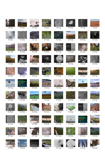
Our aim, though, was to divert from the strictest sense of “strike” and move from the legacy of aerial images as dominantly associated with military survey and targeting to their parallel uses: plant growth and planetary surfaces. As a visual art practice, we chose to rely only on existing images (fig. 1). From online archives and YouTube, from commercial seed bombing adverts to precision farming, from historical footage of plant physiology and time-lapse images to data visualization of growth, we assembled a range of surfaces that were tied together with the rhetoric of fabrication of images as fabrication of surfaces, and fabrication of movement as fabrication of growth. In other words, our problem space also responded to Farocki’s note on the method of the double (projection), to his own reflections upon seeing his Eye/Machine series on machine vision and operational images of war: “I was struck by the horizontal connection of meaning, the connection between productive force and destructive force.”3 This connection is also a central aesthetic and epistemic theme in Farocki’s work, or, as Volker Pantenburg argues, “If we try to pinpoint one recurring interest that has preoccupied Farocki both in his filmmaking and his theoretical efforts, it is the question of comparing images.”4
In Seed, Image, Ground, the sound design by María Andueza Olmedo takes over the scene even before images appear. While their movement across the split screen space is the central rhythmic element, the sound has its own narrative and non-narrative qualities. The remediation of the mechanical airlift of the helicopter rotors sets a backdrop harking back to 1970s cinema. The whirling trope familiar from Apocalypse Now (1979) is replaced by another 1970s cinematic maneuver: that of Andrei Tarkovsky’s Mirror (1975), where the mystical wind that blows across the crop fields is created by a helicopter carefully placed behind the camera. This sound speaks to a period that witnessed a media archeological combination of cinema and war5, which is however quickly replaced in the pace of the opening moments by the whirling rotation of a seedling. This, then, creates a disjunction between operations of war and growth. Hence, the opening question of the voice-over—“How do you fabricate wind?”—is not about a poetic metaphysics but about specific situations in cultural techniques of environmental management.6 We are interested in what sort of mediated ecologies are composed in the methodological arrangement of images across and on surfaces.
The video picks up on seed bombing as a motif that relates to specific techniques of enhancement of plant growth and reforesting. Seed bombing ranges in scale; it is discussed most often as a DIY technique for seeding derelict or hard-to-reach land and ground. But it is also something that features in histories, plans, and some actual projects for reforestation. The military history of the idea emerged from former RAF pilot Jack Walters’s proposals, and it was already developed twenty years ago as a commercial idea by Aerial Forestation Inc., which premised its large-scale viability on “equipment installed in the huge C-130 transport aircraft used by the military for laying carpets of landmines across combat zones,” adapting the technology “to deposit the trees in remote areas including parts of Scotland”.7 What’s interesting here is the use of aerial power—and military logistics—in relation to environmental techniques, emphasizing the superiority of the aerial view and the complexity of techniques that go into enabling this view.
As Paul Saint-Amour argues in his take on aerial imaging during the First World War and the subsequent years, a complex set of arrangements and ways of seeing as ways of knowing—a bundle of interrelated operations—enabled the “planimetric view’s construction from a diachronic series of images and moments.”8 In short, one does not simply view from above; instead, the military operations in question involved a complex constellation of scales, speeds, viewpoints, and other forms of “applied modernism”9, which worked through the figure of the photomosaic surface. The multiple shots taken were temporally and dynamically out of sync because of the different speeds of airplanes doing the imaging; hence, the different scales needed to be operationally synchronized. Such techniques of making surfaces also had an impact on postwar territorial management. Indeed, the beauty of their applicability was to offer the illusion of simultaneity of areas of a territory stitched together into one surface, where military techniques fed into different forms of aerially driven bureaucracy and design, such as urban planning.10
In other words, cognizant of the trajectories of aerial views but also techniques of the surface, a misuse of military equipment11 applies to environmental management as well. We shift gradually from the operational sphere of the military to a constellation of images that speak of:
1) Plant growth modelled as an image
2) Growth/transformation expressed in moving images
3) Territorial management as a matter of imaging, with images and data brought together for the growth and management of territories
We are currently writing a book on the question of surface as it emerges in the interplay between vegetal surfaces and screen surfaces. That work delves in more detail into some historical scenes of nineteenth-century plant physiology and the use of images and apparatus in laboratory practices. Our aim is to build a case for a media ecology of vegetal surfaces across different scales. From plants to large-scale growth surfaces, many themes of the Anthropocene scholarship of past years have already revolved around the “critical zone” of photosynthesis and the patches of biomes that define one key aspect of planetary life. Such formations are of interest to practitioners such as architects and designers as they visualize the planetary in new, complex ways; and they are also of interest to interdisciplinary scholarship that aims to decipher links between technical knowledge systems and material dynamics of energy, growth, and plant life.
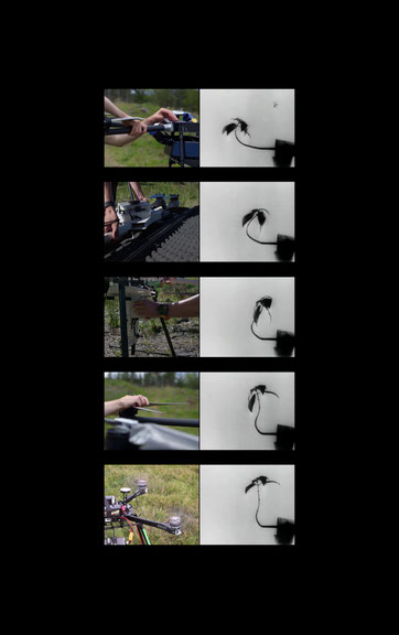
We work with scientific studies, inspired by methods that involve historical material, but we also extend the question of the plant surface into different scales: the definition of what is growth, and how images are incorporated into an understanding of growth. For this purpose, we examine photographic images and diagrams, and also the historical and more recent techniques of “time-lapse” using the cinematic technology that entered the scene around the fin de siècle (fig. 2), exploring how, more recently, this technology has been taken further by deploying large-scale datasets and also making territories into manageable data images, such as in precision farming. Digital ecologies are also concrete ecologies, as is made clear through a focus on agriculture and rural life as sites of intensive investment in new digital technologies.
The operational image has come to refer to images that do not primarily represent but are instead part of an operation.12 These include, for example, industrial and scientific images, images that function in systems, or images for navigation and guidance or measurement purposes. The term has recently mushroomed to encompass machine vision and AI. We, however, extend the use of the term in order to, first, engage with the operationalization of processes of light as they measure plants and become part of the epistemic operation (epistemic with very close goals related to industry and agriculture) and, second, to also include the operationalization of large-scale areas like farms as part of data-driven operations. We thus call to mind a crucial theme often ignored in media and other research: that infrastructures of urbanism extend to rural areas, too, including AI, blockchain, and other techniques dealing with datasets consisting of biological organisms and ecological areas such as in plantations and farming.13
II
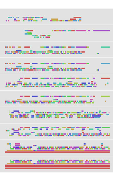
Our images are found images; the video essay does not include any sequences we filmed ourselves. They are sourced from multiple areas: from commercial material, promotional and casual footage, as well as less casual projects. This is a montage project (fig. 3), a project of problematics and composition.14 Removed from their original arrangement, the images are compiled and arranged into a split screen space where, echoing Christa Blümlinger on Farocki’s multiscreen projections, “the organisation of images appears much more important than the method used to record or generate them”.15
As per the theme of the ecoaesthetic, the split screen is used for the double articulation of image and landscape, image and territory. Technical images in plant physiology and agricultural management (including soil maps and other specialist techniques of early data visualization) constitute one reference point for the epistemological function of what images do in scientific practices.
Our work is also an assembly in a particular sense, with a nod to the historical archives as well as contemporary images. There is no simple causality that the images express in terms of what force impacts which thing, what surface becomes operative and which surface becomes data. That would be too crude of an assumption. Instead, the scenes relate to a series of images that form and formulate surfaces. When we are interested in the question of the plant and territorial surface, we engage through the image surface. When we are dealing with image (media) surfaces, it leads us to ask how they are modeled, which material base and reference is apt when considering the contemporary ecoaesthetic situation. The images thus investigate surface inscriptions.
The aerial view is likely to play a central part in the repertoire of techniques of air, but it also includes the idea of large-scale territorial planning, measurement, and survey. It is by making the territory into an image that a particular operationalization becomes possible, including for growth. We juxtapose as images that define or focus on space several different sets, contexts, and archival sources: laboratory images of growth; a set of scientific procedures and images that have been instrumental since the nineteenth century in such operations as the measurement of plants for the purposes of plant physiology; seed bombing and regreening of surfaces of growth; and precision agriculture that visualizes the surface anew based on processed data relations, even AI techniques, representing what we coin “platform ruralism”: a mode of management of large-scale growth surfaces through an agglomeration and processing of data on corporate and other platforms that then feed back onto the surface as agricultural operations, whether mechanical or chemical. Platform urbanism16 has come to refer to data platforms for the gathering, circulation, and analysis of data in smart cities, but the term can also be extended to non-human life contexts of plants and growth, entailing a variety of data points that do not refer to the usual sphere of media in urban consumer use but to its long back trail in rural lands and environmental conditions.
Writing about the use of multiple projections in video art at the turn of the twenty-first century, Liz Kotz argues that “images find their natural home in the emerging world of ‘information architecture,’ in which every building functions as a kind of image and every built surface promises to contain some type of networked display”.17 While the argument typically assumes the surfaces of the architectural building or the urban space, as in Giuliana Bruno’s landmark work (2014), in Seed, Image, Ground we extend this interweaving to other built environments such as those in aerial reforestation, landscape restoration, and agriculture.18 Every vegetal surface could function as a kind of image and every landscape would promise to behave as a networked screen.19
“The future of the movies,” said Abel Gance, “is a sun in each image”20. While Gance’s phrase recalls what Nadia Bozak has described as the “elemental solar origins”21 of cinema and its fossil fuel materiality (Bozak 2011: 35), here it opens up a space where images and vegetal surfaces meet. Graig Uhlin has written about “vegetal filmmaking,” “where vegetal being is given expressive form through a filmmaker’s particular deployment of plants as a structuring element of their work”22, while taking into account at the same time that both images and plants carry out a conversion of solar energy.23 In this context, and beyond Gance’s take on solarity, the surface of our split screen, as well as the related “emerging world of information architecture” that pervades the built environments of platform ruralism, makes images and plants coalesce as surfaces accelerated by the same diagram.
We articulate the series of surfaces as various series of image problems: Territorial surfaces and plant surfaces, Plant surfaces and agricultural surfaces, Surveys, landscapes, and data surfaces.
These series of surfaces are an ecoaesthetic angle by which to view digital ecology as well: a fabrication of images that are part of techniques of management and control, extraction and growth.
The full-length version of this essay has been published in Journal of Visual Art Practice, Volume 20, 2021 – Issue 1–2; with kind permission by Taylor & Francis Ltd.
[1] Sean Cubitt, Finite Media. Environmental Implications of Digital Technologies. Durham 2017.
[2] https://www.fotomuseum.ch/de/cluster/24/.
[3] Harun Farocki, Cross Influence/Soft Montage, in: Antje Ehmann/Kodwo Eshun (Hg.), Harun Farocki. Against What? Against Whom? London 2009, p. 71.
[4] Volker Pantenburg, Working Images: Harun Farocki and the operational image, in: Jens Eder/Charlotte Klonk (Hg.), Image Operations: Visual Media and Political Conflict. Manchester 2016, p. 54.
[5] Paul Virilio, Krieg und Kino. Logistik der Wahrnehmung. Frankfurt am Main 1989.
[6] Bernhard Siegert, Cultural Techniques. Grids, Filters, Doors, and Other Articulations of the Real. New York 2015.
[7] Paul Brown, Aerial bombardment to reforest the earth, in: The Guardian, 2nd September 1999.
[8] Paul K. Saint-Amour, Photomosaics: Mapping the Front, Mapping the City, in: Peter Adey/Mark Whitehead/Alison Williams (Hg.), From Above: War, Violence and Verticality. London 2014.
[9] Ibid.
[10] Ibid., p. 113.
[11] Friedrich Kittler, Rockmusik − ein Mißbrauch von Heeresgerät, in: Charles Grivel (Hg.), Appareils et machines à représentation (Mannheimer Analytica). Berlin 1988.
[12] Harun Farocki, Phantom Images, in: Public 29, 2004, p. 12–24.
[13] Xiaowei Wang, Blockchain Chicken Farm. New York 2020.
[14] Celia Lury, Problem Spaces. How and Why Methodology Matters. Cambridge 2021.
[15] Christa Blümlinger, The Art of the Possible: Notes About Some Installations by Harun Farocki, in: Art and the Moving Image: A Critical Reader. London/New York 2008, p. 276.
[16] Sarah Barns, Platform Urbanism: Negotiating Platform Ecosystems in Connected Cities. Basingstoke 2019.
[17] Liz Kotz, Video Projection: The Space Between Screens in Art and the Moving Image, in: Art and the Moving Image: A Critical Reader. London/New York 2008, p. 383.
[18] Giuliana Bruno, Surface: Matters of Aesthetics, Materiality, and Media. Chicago 2014.
[19] Kotz, Video Projection.
[20] Nadia Bozak, The Cinematic Footprint: Lights, Camera, Natural Resources. New Brunswick 2018, p. 34.
[21] Ibid., p. 35.
[22] Graig Uhlin, Plant-Thinking with Film: Reed, Branch, Flower, in: Patrícia Vieira/Monica Gagliano/John Charles Ryan (Hg.), The Green Thread: Dialogues with the Vegetal World. Lanham 2015, p. 202.
[23] Ibid., p. 203.


